


Card 6
!! Oh dear, what a situation!!
Due to maintenance and renovation, the Vissersbrug (bridge) has been removed for a long period of time. Fortunately, there is a temporary replacement bridge in place for now.
Singing assignment:
Noorderhaven: (harbour)
Where the Lage der A transitions into the Reitdiepskade, you will find the Noorderhaven. This is the point where the river A flows into the Reitdiep. The Reitdiep is a waterway that connects to the sea (Lauwersmeer). In the 16th and 17th centuries, this was Groningen’s most important commercial harbour. At that time, it was the city’s first harbour for ships arriving from the sea.
Guest houses:
If you remember, we mentioned "hofjes" earlier. If not, take another look at the QR code on map 3. In this street you find three hofjes, named: Middengasthuis, Pieternellagasthuis and Sint Martinusgasthuis.

The Middengasthuis (Grote Leliestraat 65)
The General Deacons’ Association had previously founded the Middengasthuis on the Kleine Rozenstraat.
This almshouse was such a great success that in 1895 a second and larger Middengasthuis was built. It was intended for members of the Reformed Church aged 55 and older. Compared to other almshouses, residents paid a relatively low entrance fee. The building served as an almshouse for many years. It is now owned by a housing association.
The Pieternellagasthuis
This almshouse was founded by Ludewé Vink, in memory of her three deceased husbands and two children.
The gasthuis owes its name to Ludewé’s children: her son was named Pieter and her daughter Pieternella.
In 1871, Ludewé purchased the property on the Grote Leliestraat, and in 1877 the almshouse was established there. The almshouse had strict requirements for new residents. They were required to lead an “exemplary life,” meaning they were not allowed to cause disturbances or consume alcohol. And because Ludewé’s last husband worked on a ship, skippers were given priority for housing.
The Sint Martinusgasthuis
This almshouse on the Grote Leliestraat is designated as a municipal monument and is now inhabited by private residents. Originally, this was not the intention. The almshouse was meant for elderly Roman Catholics.
In 1869, a building application for the homes was submitted by the Roman Catholic charitable institution Love for God and Our Neighbours. Around 1880, the first residents could move into the almshouse. Conditions for the elderly included proper behaviour, meaning that disorderly conduct and immoral behaviour were not permitted. In the 1960s, interest from the Roman Catholic community declined, and “ordinary” tenants were also able to rent a home from the almshouse.
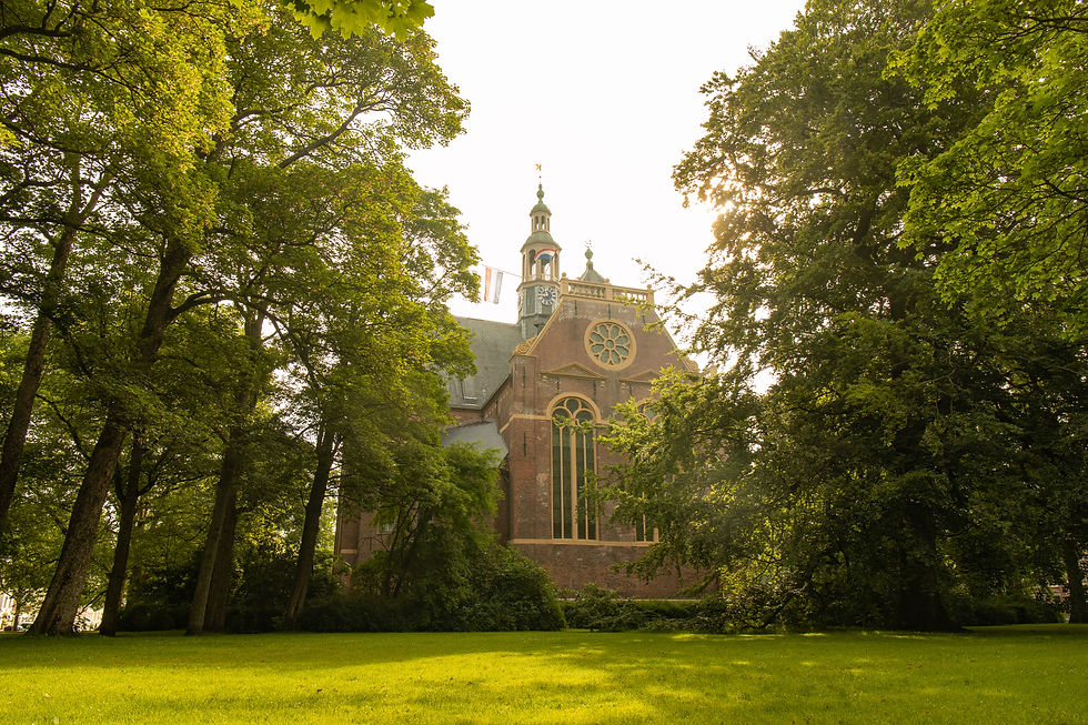
De Nieuwe Kerk (Church):
The Hondsrug is part of a larger set of sand ridges and stream valleys between the two provinces Drenthe and Groningen that is called the Hondsrug system . The Hondsrug, together with part of the surrounding area, forms the only geopark in the Netherlands.
The Hondsrug has a length of 70 kilometers and an average height of 20 meters above NAP. * All heights in the Netherlands are measured relative to the same level, the Normal Amsterdam Peil (NAP). The NAP height of 0 m is approximately equal to the average sea level of the North Sea.
Nevertheless, most of the Hondsrug is only a few meters higher than the surrounding 'valleys'. The highest northern 'hill', about 9 meters above NAP, is clearly visible in the Herestraat * Large shopping street next to the Grote Markt. That is why the side street at the highest point is called Hoogstraatje (Highstreet). You are now a little bit further to the north and at this place, on a smaller hill, you find the church.
The most southern peak is near the city Emmen (Province Drenthe) and, at 26.5 m above NAP, it is the highest natural point in the province of Drenthe. The area consists of coniferous and deciduous forests, lakes, meadows, villages, streams, shifting sands, heaths and fields.


Noorderplantsoen (Garden):
This is a beautiful garden designed in the English landscape style, where people of all ages come together. Every year in August, it becomes a bustling place as the Noorderzon Festival takes place here. It's a festival that lasts for 1.5 weeks and features theater, dance, and music. You'll find cafes and fountains as you explore. Take a moment to appreciate the breathtaking surroundings. While you do, observe how the corners of the banks reveal the history of this place. In the 17th century, the city's defensive walls and city canals were built here. In the late 19th century, it was time for something new. A park in the English landscape style was created on the old city walls, and the canals were transformed into ponds.
Have you come across a mysterious gate yet? (click here) Or have you always wondered why there is a small door in one of the hills in Noorderplantsoen? This gate is called the Sikkens Poortje (Gate).

Noorderplantsoen used to be the "edge" of Groningen. There was a large city wall here, and beyond it, there was nothing. At that time, the Sikkens Poortje served as a passageway for the residents of Groningen to inspect the area between the city wall and the moat. The Fortress Law of 1874 put an end to the city walls in Groningen, and from that point on, Noorderplantsoen became a park. In the following years, Noorderplantsoen underwent significant changes. In 1792, the gate was rented by paint merchant Wiert Willemszoon Sikkens, who used it to produce varnish. As a result, the gate became known as the "Sikkens Poortje" in the local dialect. The entrance to the 18-meter-long passage was eventually closed, and the gate served as a storage location for the city's gardening service until 1965. Are you now curious about what lies behind this mysterious little door? Brace yourself: bats! To be precise, six different species of bats.